Digital History: Using ArcGIS to Create Historic Walking Tours
This blog is by Sean Moseley, M.A. in History 2024.
Imagine you’re visiting a small town in Virginia for the first time. As you walk down the street, you notice a few houses or buildings that appear to be historic. Perhaps you see gothic window arches with stained glass, leading you to assume that the building was constructed in the nineteenth century. Or maybe you notice a home’s patchwork shingled-roof and clad board siding, suggesting an eighteenth century build date. While these are good guesses, how can you be sure about a building’s history? Furthermore, how can we as historians provide the public with tools to better understand the histories of small communities? This spring I completed an internship with the Virginia Department of Historic Resources (VDHR) and implemented two digital walking tours that seek to achieve this goal.
The VDHR had already developed a list of Virginia communities as potential locations for walking tours and gave me the option to select any community on that list. Being interested in Tidewater and maritime history, I chose the towns of Colonial Beach and City Point (Hopewell) because of their respective connections to the Potomac and James Rivers. I was also interested in these two communities because I had never researched or visited them prior to my internship! I embraced the Colonial Beach and City Point walking tours as an opportunity to learn more about Virginia history and enter a new project with few assumptions about the histories I would discover along the way.
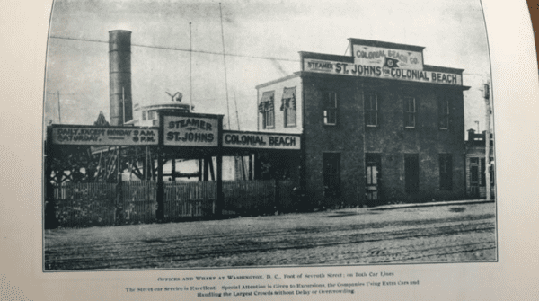
I began working on Colonial Beach, a small town nestled on the Potomac River. Established in 1892 as a vacation town for Washington D.C. and Northern Virginia residents, Colonial Beach has been a tourist destination since its creation. Even in the modern-day, the town boasts that it has the second longest beach in Virginia, followed only by Virginia Beach. I poured through any documents I could find about Colonial Beach, including: archaeological site surveys, National Historic Register Nomination Forms, and pamphlets and magazines archived at the Virginia Museum of History & Culture and the Library of Virginia.
I selected eleven historic buildings in Colonial Beach that featured diverse architecture according to their build date and told the story of the community’s late-nineteenth century development and mid-twentieth century growth.
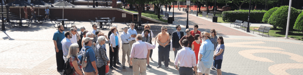
Because of the VDHR’s existing relationships with communities throughout the state, I connected with Colonial Beach Mayor Robin Schick and Director of The Museum at Colonial Beach, Mitzi Saffos and visited their town. Throughout the day of my visit, I walked the route of our tour and took photographs of each building that would be featured on our digital map.


Both Mayor Schick and Saffos were enthusiastic about my project and provided insight to the community’s history as well as their hopes for the town’s future, aspirations generally unavailable in an archive. This experience showed me that no matter how much archival research you conduct, interacting with the community that you’re researching will lead you to think about your project differently, ask questions you may have never considered, and ultimately, allow you to feel more connected to the community. Furthermore, consulting local experts who are passionate about the subject of your project can strengthen your findings and lead to a better understanding and representation of a community’s history.
After I gathered all of my information about Colonial Beach, I transitioned to the community of City Point, which straddles the Appomattox and James Rivers. As I researched City Point, I quickly realized the unappreciated significance of the area. From being selected by Christopher Newport as the original site for the first English settlement in 1607 (which was thwarted by colonists disembarking downriver at Jamestown) to being the site of General Ulysses S. Grant’s Union encampment during the Civil War, City Point has consistently served as a critically important location during Virginia’s history.
After selecting eleven buildings that represented multiple eras of City Point’s history, I traveled to the area to photograph the structures and walk the path of the tour. Upon arriving at City Point, I was met with a surprisingly large number of well-preserved historic homes clad with historic markers and waysides that explained the community’s 400 year history.

From these waysides, as well as my research prior to visiting City Point, it was clear that the Appomattox Manor, a plantation owned by the Eppes family since the mid-seventeenth century, was central to the community’s story since its origin.

Various waysides throughout City Point told the story of slavery at Appomattox Manor, however I saw potential to expand upon the available historical information about African Americans in City Point.
At this point in my research, I pulled from my History 611: American Civil War & Reconstruction Readings course with Prof. Kathryn Shively and began searching databases for information on possible refugee camps developed during the Union Encampment of the area. I found an 1864 sketch entitled “Evening African-American Prayer Meeting,” which depicted African American refugees gathered in prayer at City Point.

Additionally, I found a digital National Park Service report devoted to the migration of enslaved people from the surrounding counties to City Point during the Union occupation. Because of my previous readings, I had wondered what impact African American refugees had on the success of the Union occupation at City Point and found that enslaved people strengthened City Point’s defenses until the end of the war. I am proud to include this underreported aspect of City Point’s Civil War history into the walking tour.
Once I had collected information about Colonial Beach and City Point, I collaborated with VDHR staff members in uploading my research to a public-facing platform. Using ArcGIS, a geographic information system, we were able to map the tour. As one embarks on the tour, the digital map guides them from start to finish, with stops at selected historically significant buildings. Each building featured in both walking tours has modern photographs accompanied by information about when the building was constructed, who has used it or inhabited it in the past, as well as how the building has changed since its era of historical relevance. Some buildings feature historic photographs allowing users to see for themselves how the structure has changed over time.
My internship with the VDHR allowed me to experience the hours of research, writing, and digital editing that are required to create accurate, informative, and interesting historical narratives for public-use. Whether in classrooms or in conferences, as budding historians, we always hear about the increasing importance of incorporating technology into our research and presentation of public histories. It was fascinating to see firsthand how institutions such as the VDHR have utilized software, like ArcGIS, to preserve information, catalog and categorize sites, and present Virginia’s history to the public. Being able to travel and meet with community leaders was especially rewarding and allowed me a glimpse into life in Colonial Beach and City Point that one simply cannot grasp by only visiting an archive. Additionally, collaborating with both community leaders and the VDHR staff in obtaining information and successfully designing a work of digital history showed me that oftentimes, many hands mold a project into its optimal form before it reaches the public.
Importantly, I have learned that amateur, academic, digital, and public histories are not always exclusive to one another. By combining all of these different approaches, we can develop more inclusive, impactful, and informative historic resources for the public. My hope for the Colonial Beach and City Point Walking Tours is that they encourage the public to explore more communities throughout Virginia and remain curious about the state’s unique history and culture.
~Both tours will be published on the VDHR website.
Categories Intern Insights